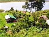
Amajambere Iwacu Community Camp
Amajambere Iwacu Community Camp - Lodge

Amajambere Iwacu Community CampKisoro, Western Region (Uganda), Uganda Lodge from R 67 (family units from R 1,076) | R 67 |
Amajambere Iwacu Community Camp is located at the entrance to Mgahinga National Park and is only 12 km from the south-western town of Kisoro, near the Rwandan border. At the camp, visitors can enjoy the magnificent views of the famous Virunga Volcanoes and take part in monkey trekking as it is located at the starting point for golden monkey trekking through the National Park.
Guests can choose between the Campsite, Dormitories or Bandas. The camp has a wide area for camping as well as five Bandas of which two serve as dormitories. The spacious gathering shelter with indoor and outdoor dining serves typical Ugandan meals and has a well-stocked canteen serving beers, sodas, snacks and basic essentials.
Amajambere Iwacu Community Camp was established in 1994 by 33 families who were displaced at the gazetting of Mgahinga Gorilla National Park. The camp runs an eco-community camp for tourists just outside the main gate of the National Park. Apart from providing accommodation for tourists, the camp also supports community-based initiatives such as a handcraft group for women. There are different volunteer projects you can get involved with during your stay; consider teaching at a local community kindergarten, teach conservation education in nearby public schools or lend a helping hand at the local health clinic.