Olkoroi Camp
Olkoroi Camp - Zelf-Zichricht

Olkoroi CampOlmesutye, Narok County, Kenya Zelf-Zichricht vanaf R 727 (familie-eenheden vanaf R 1,454) | R 727 |
Experience nature in its wildest form at Olkoroi Camp, where wildlife such as leopard, wild dogs, buffalo and elephant roam freely through the camp. Be prepared to gasp for breath as you behold the sun setting over the rolling hills and the rocky outcrops of Loita.
The Olkoroi Camp is truly community based, where it is easy for the visitors to interact with and become part of the day to day lives of the local Maasai community. The name "Olkoroi" was given to the Camp by the elders of the Community Trust. This is the Maasai name for the black and white Colobus monkeys that live along the forested Olkeju Arus River on the camp boundary. An ancient elephant migratory route that links the Forest of the Lost Child in the Loita Hills in the east with the wide open grasslands of the Maasai Mara to the west, borders the camp on the other side.
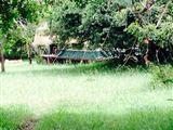
Currently the camp has four safari tents, each privately tucked away with exquisite views over the surrounding woodland and hills. Each tent has its own outside open-air shower and compost toilet. The tents accommodate two people each.
Olkoroi Camp is known for its mouth-watering meals, cooked over the open fire with freshly baked bread, baked to perfection in our organic earth oven. Self-catering groups can make use of our open-plan bush kitchen and outside mess area around the fireplace.